
Rock Bridge State Park
This post contains links to affiliate websites, such as Amazon, and we receive an affiliate commission for any purchases made by you using these links.
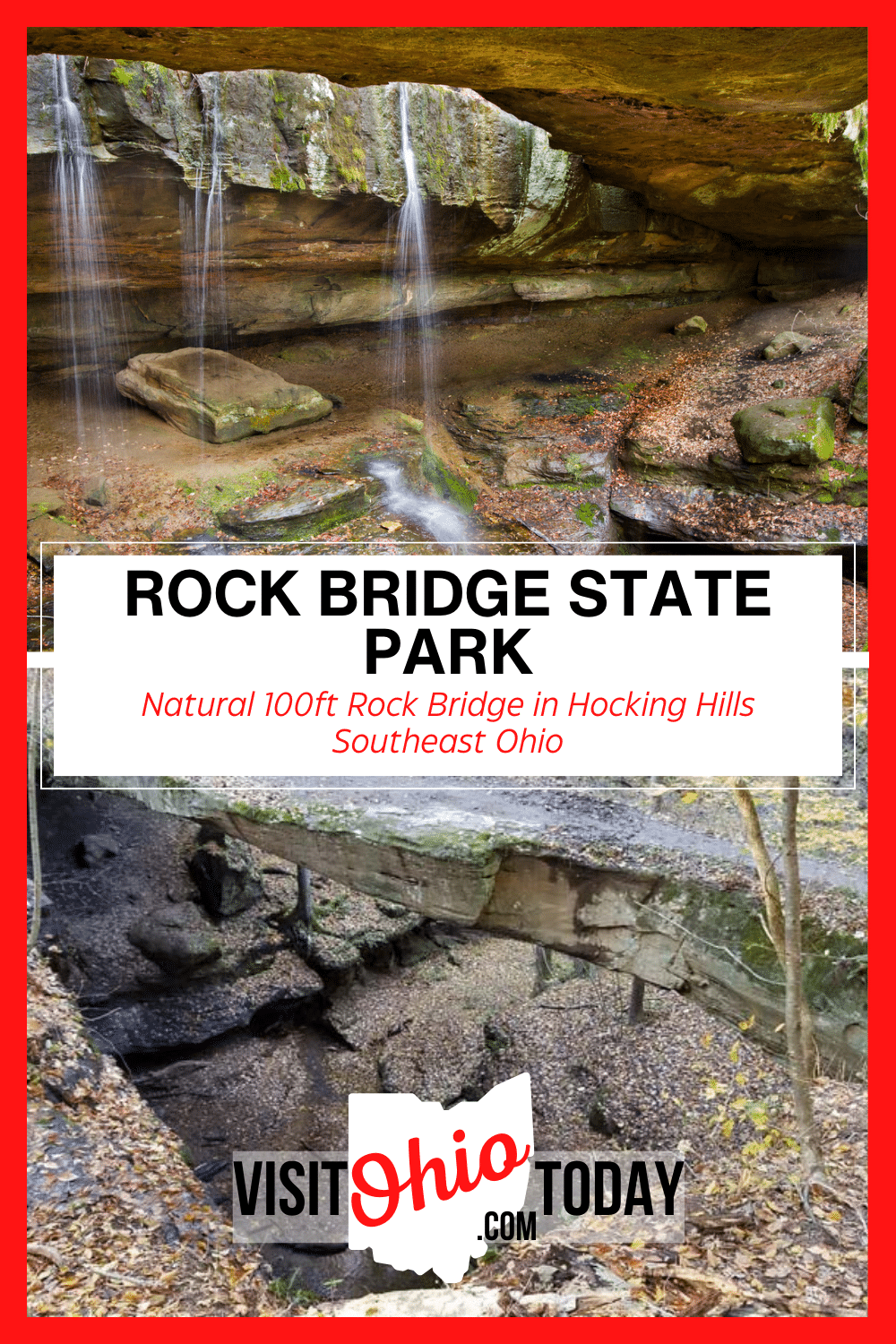
Rock Bridge State Park is a beautiful easy to easy-to-moderate hiking trail to a natural bridgeway, located in the Hocking Hills area.
About Rock Bridge State Park
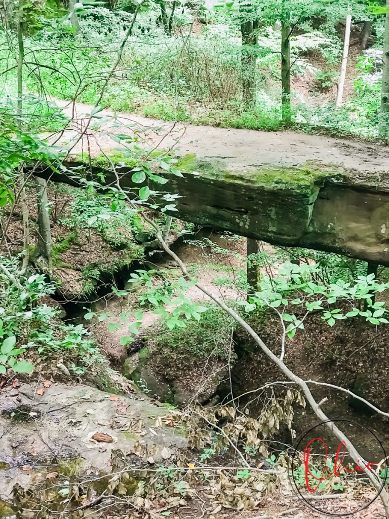
Rock Bridge State Park is located in Hocking County in the Hocking Hills area. Rock Bridge is a natural bridge (or arch) that spans about 100 feet long and is 10-20 feet wide at parts. This natural bridge was created hundreds of thousands of years ago when Ohio was under a warm inland sea.
Cindy’s Insider Ohio Tips
Rock Bridge is such a beautiful place to visit and the hike is not too difficult for kids over the age of 10. Younger children may find it testing. Please be aware that the bridge can be slippery in the wet weather, so be sure to wear good hiking shoes here.
Trail
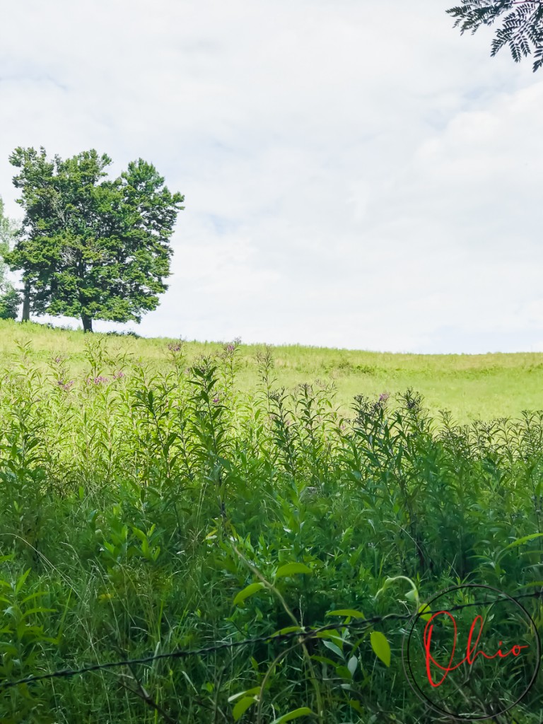
To get to this wonder of nature, you will access the trail from the parking lot. The trail starts with a connector trail from the parking lot. This is an easy trail, just less than a ½ mile. It is mostly a narrow piece of land without much shade. The connector trail is a gentle walk.
The trail walking to the bridge forms a 1 mile circle, called Natural Bridge Trail. When the trail splits there isn’t a better way to hike (right or left), so we’ll let you choose your own adventure when it comes to that.
If you go to the left, you will find Rock Bridge about half way through the loop. At that point, you can circle back the way you came or finish out the loop.
If you decide to go right (or straight) when the trail splits you will need to pay attention when the trail splits again to the right. When the trail splits a second time (to the right), that is Rock Bridge Shelter Trail, which is a ¾ mile loop. If you want to extend your hike, you can add this in. If you want to see the bridge only, go left and stay off the shelter trail when it opens up to the right.
Once you are at the bridge, there is a spur trail that leads down to the water. This is often accessed by those taking part in a river tour via Hocking Hills Canoeing.
This trail is not stroller-friendly. There are steps and turns made of rock and trees. There are sunny spots but there is lots of shade once you are on the Natural Bridge Trail. This trail has been labeled between easy and moderate.
A trail map for Rock Bridge State Nature Preserve is available.
Overall, this was a great trail. We hiked it during the summer. The trail was not that busy during the week. Be sure to bring water and check the weather before you head out! As always use extreme caution when hiking or visiting the Rock Bridge
Rock Bridge State Park Quick Facts
- No restrooms
- No pets
- Easy to Moderate Hike
- Approximately 2.8 miles
- Flat, incline, decline, natural steps
- Not stroller friendly
- Narrow trails at times
Where is Rock Bridge State Park Located?
- Address: 11475 Dalton Road, Rockbridge, Ohio 43149
- Website
Location Map for Rock Bridge State Park
Let’s Go to Rock Bridge State Park!
Have you been hiking at Rock Bridge State Park? Did you find it difficult in places, or were you happy with the surfaces? We would love to know! Leave a comment below and share your experience.
If you would like more things to do and places to visit in Hocking Hills, check out our Hocking Hills Category.
Hello! We have done our very best to ensure that the accuracy of events, hours, addresses, etc, are up to date. Please know that information can change due to weather, updated health and safety challenges, etc. If you find incorrect information, please send us an email at [email protected], and we can get it updated.
To be updated and stay connected, subscribe to our newsletter.


This is such a hidden gem of the Hocking Hills Area. We hiked it but want to do a canoe trip next time!
We also want to try the canoe trip there as well!